

PASSPORTING OF AREAS
We offer technical passporting of prominent areas within any site using drones. From manufacturing plants to logistics parks, sports complexes, accommodation complexes, parks, golf courses, urban areas, etc.
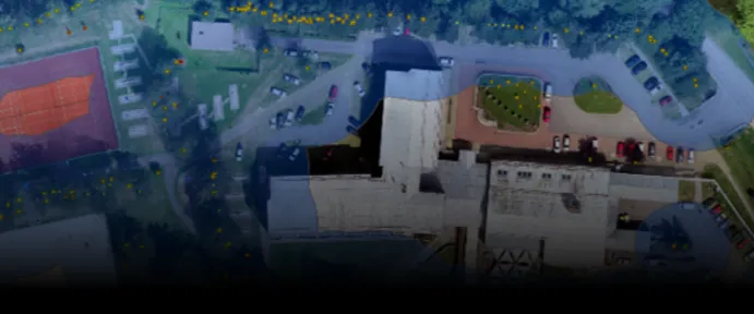
Our service effectively and significantly replaces conventional surveying services focused on area mapping. The time savings in implementation are approximately 50%, while the financial savings can be up to 20% compared to traditional surveying methods. The work also includes the measurement of a set of reference points, which increases the overall output accuracy to 99%. We will ensure precise determination of area measurements for:
- Built-up areas
- Roads, lay-by, and parking spaces
- Technologies
- Sidewalks
- Green areas, water bodies, and more
You Will Gain With Us
- A tool for effective management of your property
- Detailed overview of measurements with centimeter-level accuracy
- Interactive orthophoto map of the area in the form of a multi-layered PDF file
- Option to link the output with the cadastral map revenue
- Ability to integrate the output into your GIS system
- A basis for planning design work
- Comprehensive view of the property area in high resolution
- Faster and more efficient data collection
- Output processing within days
- Outputs can be verified by an authorized surveyor


A non-binding inquiry?
We will be happy to help you, please contact us.