

Drones at your service
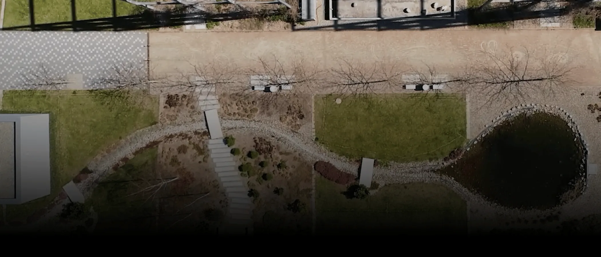
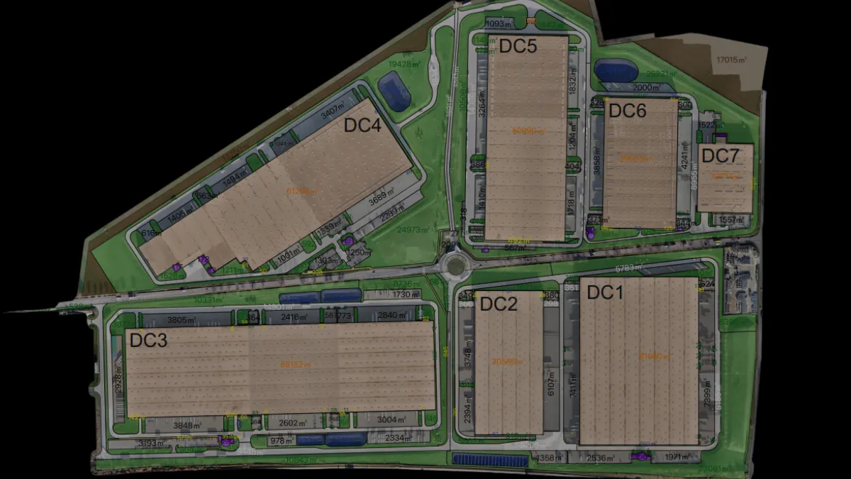
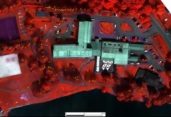
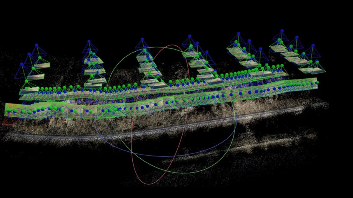
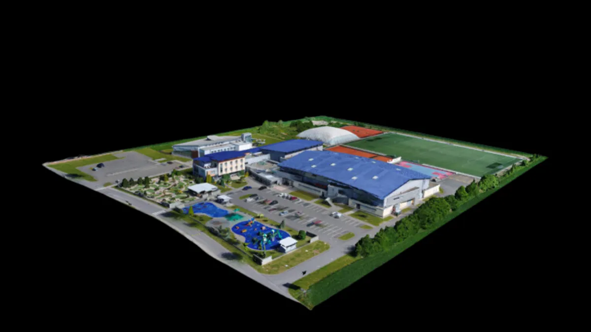
Industrial inspection, 3D models and visualization, calculations of volumes, lengths and areas, design work. Photomosaics, Orthophotomaps in coordinate system with high resolution and map accuracy. Using drones to get precise documentation of your property.
Wide Range of Applications
- Industrial Inspection: RGB or IR spectrum inspections of building envelopes and structures, condition monitoring
- 3D Models and Visualizations: Volume, length, and area calculations, design work, etc.
- Photo Mosaics: High-resolution aerial and ground images (mm/pix)
- Orthophotos: High-resolution orthophotos in a coordinate system with mapping accuracy
- Asset Mapping: Mapping areas for determining surface areas and boundaries of significant spaces
- Data Analysis and Comprehensive Processing: Thorough analysis and processing of collected data
Documentation by drones


A non-binding inquiry?
We will be happy to help you, please contact us.